Arches National Park
Trip Assistant
How Much Time?
There’s only about 15 miles of maintained trails in the park, so you can see the majority of popular sites in a sunup-to-sundown day, no problem.
But the park says there are more than 2,000 arches here, leaving plenty of room for independent exploration. It’s also a wonderful photography destination. So, if you enjoy taking pictures, spend a few mornings/evenings.
This is also one of the most beautiful corner’s of our country. Set aside some time to enjoy a bunch of the spots pinned on the road trip map, especially if you’d like to shake the Moab crowds for a bit.
Need to Know
- A timed-entry permit is required during peak visitation.
- A timed-entry permit does not guarantee parking.
- Reservations are required for camping most of the year. It’s a fantastic campground but hard to get a site.
- Visitation peaks in summer but it’s also the worst time to visit, due to (often) oppressive heat.
- Upper Delicate Arch Viewpoint might sound like a good idea (it’s very short). And it is a cool view, but you’re a long way from the arch and the elevation gain is nearly the same as the trail to it.
Highlights
- Fiery Furnace
- The Park Road
- Windows
- Balanced Rock
- Park Avenue Viewpoint
- Skyline Arch
Activities
- Hiking
- Backpacking
- Biking
- Rock Climbing
Favorite Trails
Easy
Moderate Strenuous *Links to AllTrailsWhen To Go?
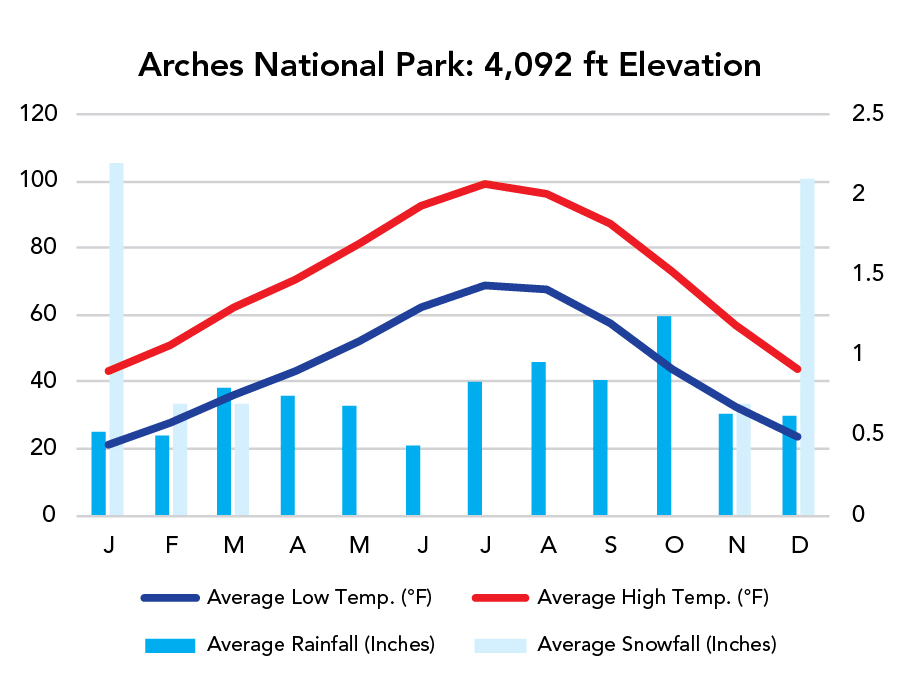
Weather
Visitation
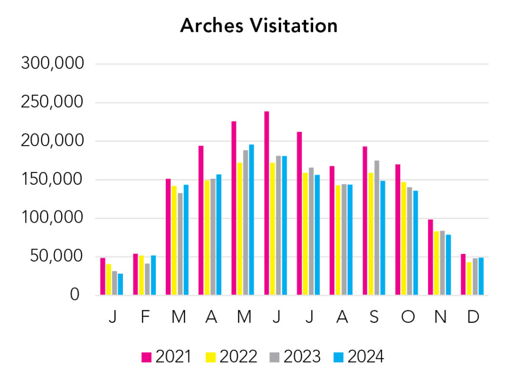
Summer is the worst time to visit. Not because it’s the busiest but because it’s the hottest (often 100+°F)! Spring and fall tend to be the best times to drop in for a visit, but winter isn’t bad either. Red rock and snow go well together (but snow is uncommon).
Park Map Downloads
Road Trips
Helpful Tools
Below you'll see a Google Map to help plan road trips from the east (Black Canyon of the Gunnison), north (Uinta Mountains/Dinosaur National Monument), west (Canyonlands), and south (Petrified Forest). It’s a good start, but I’d highly recommend making your own. Google My Maps, Wanderlog, Roadtrippers, and TripIt are incredibly useful trip planning tools. Find what works best for you!
There’s much more to our country. Here’s another Google Map with points of interest across all types of public land.
For campers, here’s a Google Map with National Forest campgrounds. National Park campgrounds are difficult to reserve (there are about 200!). With nearly 5,000 national forest campgrounds, you can usually pull in and find a spot.
Highlights
There’s a major obstacle to the north in the form of the San Rafael Swell and the Green River, but this region is a great deal of fun, and it’s almost all public land. I only included easy-to-get-to places. There’s a lot of dirt roads out here.
If you like this, please check out my books or Buy Me a Coffee (more likely some fuel 🙂