White Sands National Park
Trip Assistant
How Much Time?
With only nine miles of trails, you don’t need much time to see a lot of the park, but it is a setting that changes dramatically, season-to-season, day-to-day, hour-to-hour, so there is value in sticking around for a while to watch it change. Weather is usually good here, but with Lincoln National Forest to the east and Organ Mountains-Desert Peaks National Monument to the west, you could spend a few days and not get bored.
Need to Know
- The park closes overnight (typically open from 7am until sunset). You can spend the night here thanks to ten (first-come, first-served, reserved at the entrance booth) backcountry sites in the dunes. You do not want to be camping out there in high winds.
- Missile testing regularly delays the park’s opening. Check the park website (or call 575.479.6124).
- Sunset Strolls are offered most days. All you have to do is show up at the meeting area (4.7 miles from the entrance) about an hour before sunset.
- Summers are hot but the sand stays cool!
Highlights
- Heart of the Sands
- Lake Lucero
- Sand Sledding
- Great Picnic Areas
- Sunset
Activities
- Hiking
- Sledding
- Biking
- Horseback Riding
- Photography
When To Go?
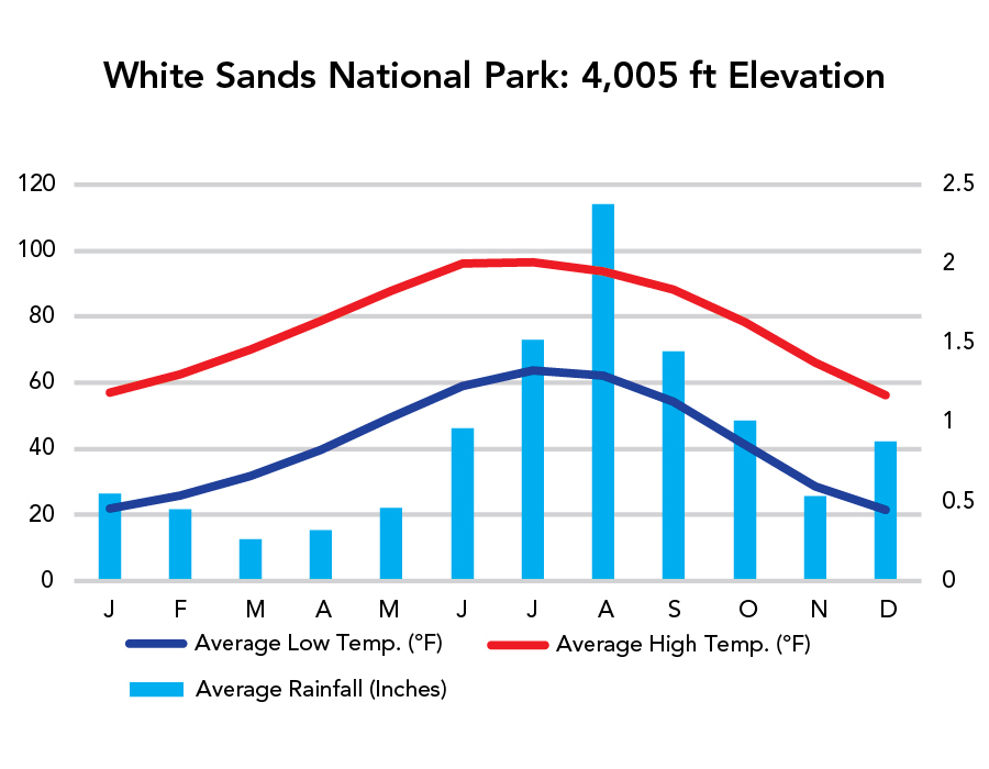
Weather
Visitation
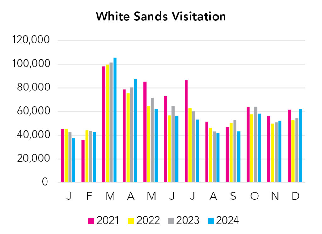
Spring break is the busiest. Summer is less-than-ideal. The heat is multiplied here, as the white sand reflects all the sun (and it’s usually sunny). On the positive side, since the sand reflects light instead of absorbing it, it’s always cool to the touch. Kick off your shoes and enjoy!
Park Map Downloads
Road Trips
Helpful Tools
Below you'll see a Google Map to help plan road trips from the east (Carlsbad Caverns), north (Great Sand Dunes), west (Saguaro), and south (El Paso, TX). It’s a good start, but I’d highly recommend making your own. Google My Maps, Wanderlog, and TripIt are incredibly useful trip planning tools. Find what works best for you!
There’s much more to our country. Here’s another Google Map with points of interest across all types of public land.
For campers, here’s a Google Map with National Forest campgrounds. National Park campgrounds are difficult to reserve (there are about 200!). With nearly 5,000 national forest campgrounds, you can usually pull in and find a spot.
If you like this, please check out my books or Buy Me a Coffee (more likely some fuel 🙂